top5に行ってみよう!! 福岡編
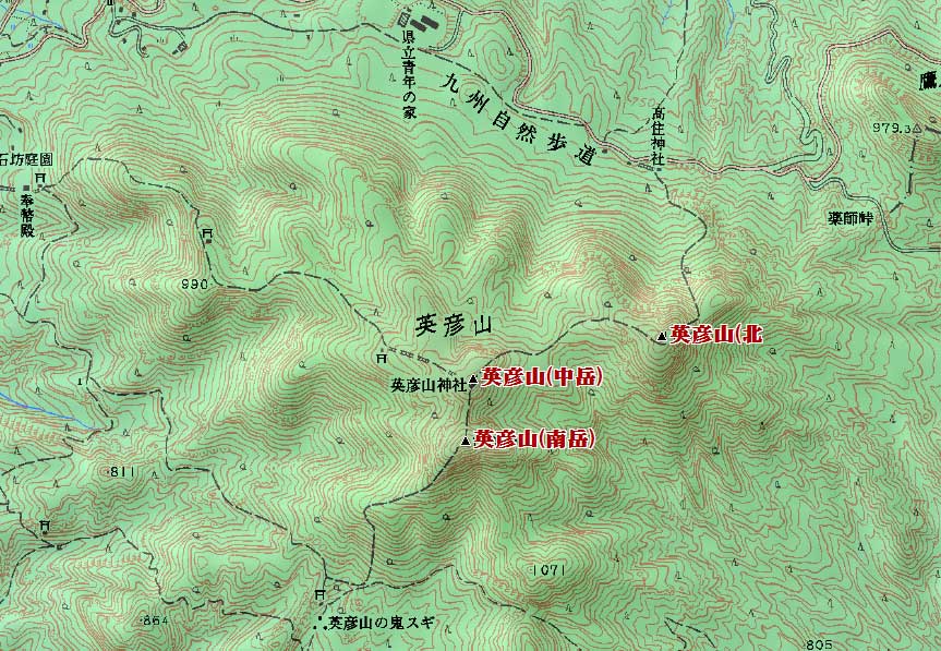
英彦山(南岳)1199.6m、英彦山(中岳)1188.2m、英彦山(北岳)1192mは 英彦山(1199.6 m)
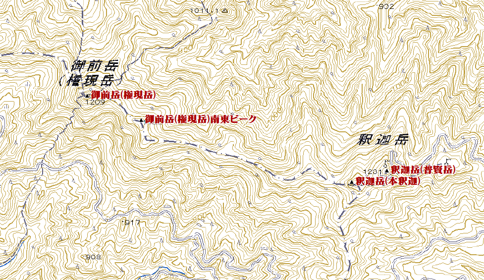
1.釈迦岳(本釈迦) ( シャカダケ 1229.5 m) 福岡県八女市・大分県日田市
<33.111272 130.531311>
[googlemap lat=”33.18684101030873″ lng=”130.88699340820312″ width=”300px” height=”150px” zoom=”10″ type=”G_NORMAL_MAP”]33.186841,130.886993[/googlemap]
★
2.御前岳(権現岳)( ゴゼンダケ(ゴンゲンダケ) 1209 m) 福岡県八女市・大分県日田市
<33.113004 130.521642>
[googlemap lat=”33.191904938792256″ lng=”130.87072849273682″ width=”300px” height=”150px” zoom=”12″ type=”G_NORMAL_MAP”]33.186841,130.886993[/googlemap]
★
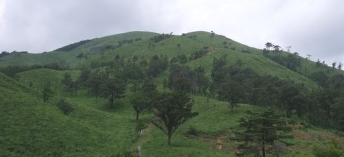
3.英彦山 ( ヒコサン 1199.6 m) 福岡県田川郡・大分県中津市
<33.283449 130.553350>
[googlemap lat=”33.47630569333514″ lng=”130.9260892868042″ width=”300px” height=”150px” zoom=”10″ type=”G_NORMAL_MAP”]33.186841,130.886993[/googlemap]
★
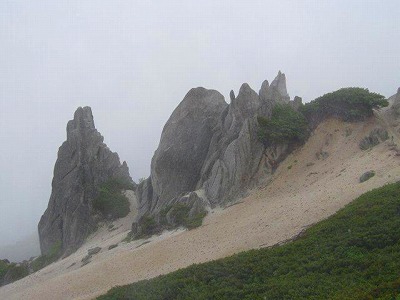
4.犬ヶ岳 ( イヌガタケ 1130.8 m) 福岡県豊前市・大分県中津市
<33.304396 131.000618>
[googlemap lat=”33.51238083837854″ lng=”131.0017704963684″ width=”300px” height=”150px” zoom=”10″ type=”G_NORMAL_MAP”]33.186841,130.886993[/googlemap]
★
5.脊振山 ( セフリサン 1054.6 m) 福岡県福岡市・佐賀県神埼市
<33.261118 130.220704>
[googlemap lat=”33.43631201362654″ lng=”130.36887645721436″ width=”300px” height=”150px” zoom=”10″ type=”G_NORMAL_MAP”]33.186841,130.886993[/googlemap]
1.小岳 ( コタケ 21 m) 福岡県福岡市東区
<33.390913 130.195967>
[googlemap lat=”33.652601518537125″ lng=”130.33332109451294″ width=”300px” height=”150px” zoom=”11″ type=”G_NORMAL_MAP”]33.652602,130.333321[/googlemap]

★
2.城山 ( シロヤマ 26 m) 福岡県福岡市東区
<33.384610 130.252443>
[googlemap lat=”33.64623360770345″ lng=”130.42326092720032″ width=”300px” height=”150px” zoom=”12″ type=”G_NORMAL_MAP”]33.652602,130.333321[/googlemap]

★
3.麁原山 ( ソハラヤマ 33.2 m) 福岡県福岡市早良区
<33.343711 130.212508>
[googlemap lat=”33.57680803305405″ lng=”130.3569781780243″ width=”300px” height=”150px” zoom=”13″ type=”G_NORMAL_MAP”]33.652602,130.333321[/googlemap]

★
4.岬ノ山 ( ハナノヤマ 40 m) 福岡県北九州市若松区
<33.533350 130.474917>
[googlemap lat=”33.892540537927616″ lng=”130.7969570159912″ width=”300px” height=”150px” zoom=”12″ type=”G_NORMAL_MAP”]33.652602,130.333321[/googlemap]

★
5.大岳 ( オオタケ 41 m) 福岡県福岡市東区
<33.392280 130.200790>
[googlemap lat=”33.65639703371006″ lng=”130.33562779426575″ width=”300px” height=”150px” zoom=”12″ type=”G_NORMAL_MAP”]33.652602,130.333321[/googlemap]
★
5.魚見山 ( ウオミヤマ 41 m) 福岡県遠賀郡芦屋町
<33.541118 130.394548>
[googlemap lat=”33.90329811980151″ lng=”130.66262125968933″ width=”300px” height=”150px” zoom=”12″ type=”G_NORMAL_MAP”]33.652602,130.333321[/googlemap]

★
5.妙見山 ( ミョウケンサン 41 m) 福岡県北九州市八幡西区
<33.521910 130.464391>
[googlemap lat=”33.87213480741482″ lng=”130.77895402908325″ width=”300px” height=”150px” zoom=”12″ type=”G_NORMAL_MAP”]33.652602,130.333321[/googlemap]

★
レポート待ってます!!
2010 年 7 月 23 日