top5に行ってみよう!! 京都編
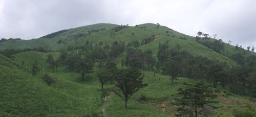
1.皆子山 ( ミナコヤマ 971.5 m) 京都府京都市・滋賀県大津市
<35.120818 135.500651>
[googlemap lat=”35.20226585040101″ lng=”135.83514869213104″ width=”300px” height=”150px” zoom=”10″ type=”G_NORMAL_MAP”]35.202266,135.835149[/googlemap]
★
2.峰床山( ミネトコヤマ 970 m) 京都府京都市
<35.141483 135.492547>
[googlemap lat=”35.23745679958968″ lng=”135.82378149032593″ width=”300px” height=”150px” zoom=”12″ type=”G_NORMAL_MAP”]35.202266,135.835149[/googlemap]
★
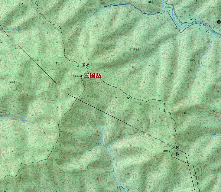
3.三国岳 ( ミクニダケ 959 m) 京都府京都市・京都府南丹市
<35.191434 135.473813>
[googlemap lat=”35.320620684765665″ lng=”135.79400092363358″ width=”300px” height=”150px” zoom=”13″ type=”G_NORMAL_MAP”]35.202266,135.835149[/googlemap]
★
4.鎌倉山 ( カマクラヤマ 950.5 m) 京都府京都市・滋賀県大津市
<35.150606 135.503880>
[googlemap lat=”35.251693183348316″ lng=”135.84413677453995″ width=”300px” height=”150px” zoom=”12″ type=”G_NORMAL_MAP”]35.202266,135.835149[/googlemap]
★
5.地蔵山 ( ジゾウヤマ 947.6 m) 京都府京都市
<35.043137 135.372443>
[googlemap lat=”35.0754411941237″ lng=”135.62366724014282″ width=”300px” height=”150px” zoom=”12″ type=”G_NORMAL_MAP”]35.202266,135.835149[/googlemap]
1.妙見山 ( ミョウケンサン 30 m) 京都府宮津市
<35.361216 135.132950>
[googlemap lat=”35.60349193667184″ lng=”135.22488176822662″ width=”300px” height=”150px” zoom=”12″ type=”G_NORMAL_MAP”]35.202266,135.835149[/googlemap]

★
2.愛宕山 ( アタゴヤマ 55 m) 京都府福知山市
<35.175749 135.084151>
[googlemap lat=”35.299558068197456″ lng=”135.14493852853775″ width=”300px” height=”150px” zoom=”13″ type=”G_NORMAL_MAP”]35.202266,135.835149[/googlemap]

★
3.茶臼山 ( チャウスヤマ 57 m) 京都府舞鶴市
<35.260628 135.192219>
[googlemap lat=”35.435078715453244″ lng=”135.32297015190125″ width=”300px” height=”150px” zoom=”12″ type=”G_NORMAL_MAP”]35.202266,135.835149[/googlemap]

★
4.四面山 ( シメンザン 60 m) 京都府舞鶴市
<35.281208 135.231949>
[googlemap lat=”35.470131316159694″ lng=”135.38879424333572″ width=”300px” height=”150px” zoom=”12″ type=”G_NORMAL_MAP”]35.202266,135.835149[/googlemap]

★
5.倉梯山 ( クラハシヤマ 93 m) 京都府宮津市
<35.331789 135.085388>
[googlemap lat=”35.55482325410506″ lng=”135.14831274747849″ width=”300px” height=”150px” zoom=”13″ type=”G_NORMAL_MAP”]35.202266,135.835149[/googlemap]

★
レポート待ってます!!
2010 年 8 月 28 日